Hurricanes
Hurricane Beryl – Update 2
 CAT 5
CAT 5
 30 June, 2024
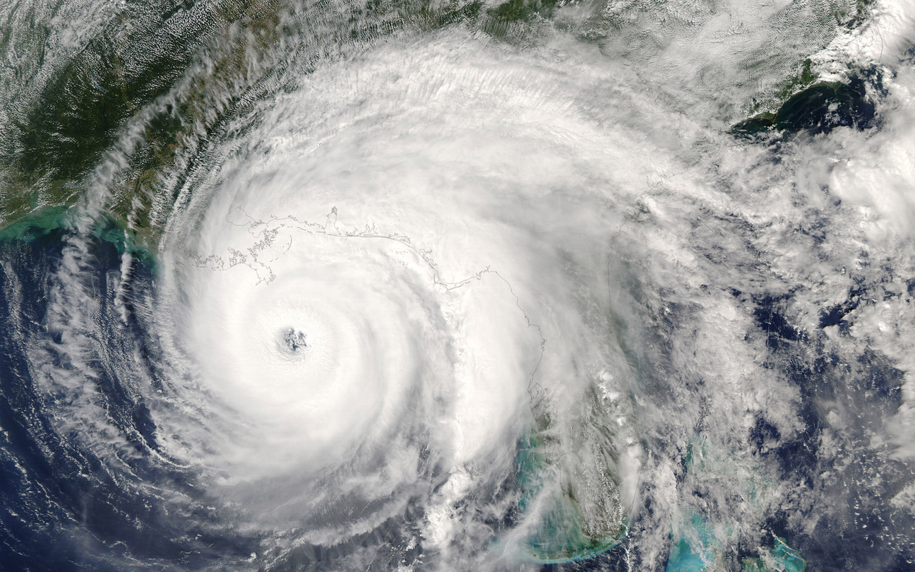
 Hurricane Beryl made history as the earliest hurricane of its intensity (Cat 5) in the North Atlantic. It was a stark reminder of the extreme volatility that is expected to continue throughout the remainder of the year.
With winds reaching in excess of 157 mph, Beryl became one of the few hurricanes to reach Cat 5 intensity. Having formed in late June, Beryl exhibited exceptional intensification due to above-normal water temperatures in the Atlantic and escalated from Cat 1 to Cat 5 in the space of 24 hours. This is another example of a rapid intensification event, similar to Otis last year.
Beryl was a reminder that storms are becoming increasingly difficult to predict. Current water temperatures in the Atlantic are near record highs, which can cause any tropical storm to rapidly intensify in just over 24 hours and turn it into a very powerful and life-threatening hurricane.
Hurricane Beryl is the first of what is expected to be a busy season. There are predictions of around 25 named storms, 14 of which will be hurricanes, and 7 major hurricanes of at least Cat 3 or above. Three major hurricanes per season has been the average in recent years.
With preliminary damages estimated in excess of USD $20 billion, for now there is a sense that by “miracle” the worst might have been avoided with Hurricane Beryl. But in everybody’s mind, the question remains, “for how long?”. What is to become of Chris, Debby, Ernesto, Francine, Gordon, Helene, Isaac, Joyce, Kirk, Leslie, Milton, Nadine, Oscar, Patty, Rafael, Sara, Tony, Valerie, and William? And will we see the need for additional references to be added to that list?
Timeline and Path
Early Development
- 28th June – 29th June: Tropical Depression forms in the central Atlantic and quickly strengthens into Tropical Storm Beryl.
Rapid Intensification
- 30th June – 1st July: Beryl rapidly intensifies from a Tropical Storm to a Cat 4 hurricane with winds of over 150 mph as it goes past Barbados and Trinidad and Tobago.
Landfall
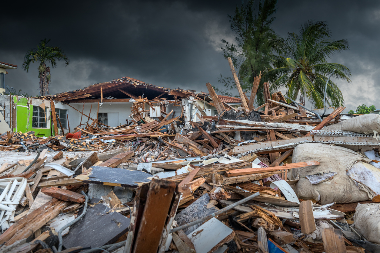
- 1st July: Beryl makes landfall as a Cat 4 hurricane on Grenada and St Vincent and the Grenadines and flattens the islands of Carriacou, la Union and Petite Martinique,
- 2nd July: Beryl strengthens further into a Cat 5 hurricane as it continues its path through the Caribbean Sea,
- 3rd July – 4th July: Beryl brushes past the southern coast of Jamaica as a Cat 4 hurricane causing heavy rainfall and landslides,
- 5th July – 7th July: Beryl weakens to a Cat 2 hurricane as it approaches the Mayan coastline of Tulum and Cancun in Mexico,
- 8th July -10th July: Beryl weakens to a Cat 1 hurricane with its remnants affecting the southeast of the US in Texas.
Damages Inflicted
Grenada (Cat 4 Landfall):
- Infrastructure Damage: High winds and heavy rains caused extensive damage to homes and buildings. Many structures were severely damaged in the capital of St. George’s and over 90% of houses in the islands of Carriacou, Petite Martinique and Union being also severely damaged or destroyed and resulting in 4 deaths.
- Agricultural Losses: Key plantations of bananas, nutmeg, and cocoa were devastated, and local farmers reported total crop losses. These crops are key to the local economy.
- Road Blockages: Uprooted trees and debris blocked major roads, hampering emergency response efforts and isolating communities inland.
Jamaica (Cat 4 Nearby / No Landfall):
- Severe Flooding: Overflowing rivers and overwhelmed drainage systems caused extensive flooding, especially in urban areas like Kingston.
- Landslides: Heavy rains, over 12 inches in some areas, caused significant soil erosion and landslides in hilly areas and rural communities, such as the Blue Mountains, where roads and villages were cut off for several days.
- Agricultural Impact: Flooded fields led to the destruction of crops such as yams, sweet potatoes, and vegetables. Farmers in parishes like St. Elizabeth faced severe losses, raising concerns about food security.
- Power Outages: Several parishes and towns, particularly those affected by flooding and landslides in the southwest, experienced prolonged outages due to inaccessibility caused by damaged roads.
Mexico (CAT 2 Landfall):
- Power Outages: Heavy rains and strong winds led to some power outages, leaving +10,000 people without power in Tulum.
- Economic Disruption: Limited damages, some closure of hotels and evacuation of tourists and locals from Holbox.
United States (Texas) (Cat 1 remnants):
- Power Outages: Heavy rains and strong winds led to widespread power outages, particularly in the Houston metropolitan area, where millions were left without power for several days due to downed lines and damaged transformers. Some areas received up to 15 inches of rain and experienced storm surges of up to 6 feet.
- Economic Disruption: Power outages forced many industries and businesses to close temporarily, leading to economic losses. In addition to the usual restaurants, retail stores, and offices being without power, shipping ports, oil refineries and other energy intensive industries also had to temporarily closed. Electricity markets being deregulated this may result in significant increased costs.
BUSINESS INTERRUPTION COVERAGE ISSUES
- Government assistance considerations
- Prevention of access – inability to access businesses due to the closure of roads
- Property damage to local businesses
- Public utilities – damage to providers of electricity, gas, sewage, and telecommunications
- Closure of premises by public authority – closure or evacuation of Insured premises
- Losses resulting from supply chain issues.
Early involvement of the appropriate experts can help with the need for any mitigation efforts.
MDD has considerable expertise in dealing with these types of claims and the complexities that may occur. Experts like those of us at MDD will stress the need for proper audit protocols, controlling and sorting of costs and accounting for any potential saved expenses.


